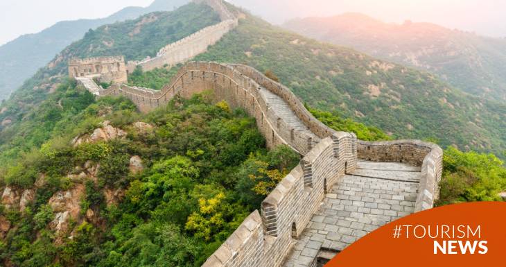
The length of the Great Wall of China has changed! Instead of the 6,300 kilometers it was believed to be, its extension is 8,851 kilometers.
This revision is not due to miraculous growth, but rather to a new measurement that relied on advanced technology, including infrared technology and the Global Positioning System (GPS), as opposed to the estimates and accounts used previously.
The main objective of the new study carried out by Chinese archaeologists and conservators is to preserve the Great Wall - declared a World Heritage Site by UNESCO two decades ago - particularly in vulnerable areas, such as the desert province of Gansu. In this region, sand storms threaten to make the wall disappear completely in just 20 years. Furthermore, according to Shan Jixiang, director of the research, the greatest risks to the integrity of this emblematic monument are climate change and the massive construction of infrastructure. Therefore, it is essential to identify the areas most susceptible to these dangers and implement appropriate protective measures.
How was this most recent measurement carried out?
It relied on advanced technologies to obtain accurate and detailed results:
Infrared Technology:
- Use of Infrared Sensors: Infrared technology played an essential role in allowing the detection and mapping of hidden or deteriorated parts of the wall that were not visible to the naked eye.
- Remote Sensing: To address areas where the wall was covered by vegetation or had suffered erosion, satellites equipped with infrared sensors were used, providing detailed images.
- Data Analysis and Processing: The data obtained through the sensors was subjected to thorough analysis with the help of advanced software, which allowed the interpretation of the images and the precise determination of the location of the structure.
Global Positioning System (GPS):
High Precision Measurement: GPS was used to obtain precise measurements of the length and location of different wall sections. Use of GPS Receivers: Field teams with high-precision GPS receivers roamed the wall, recording location data at regular intervals. Integration with GIS (Geographic Information System): GPS data was integrated with GIS software, creating a detailed and accurate map of the Great Wall, including its sinuosities and topographic variations.
Measurement Process:
- Planning and Identification of Areas of Interest: Critical areas for measurement were determined, including those that had not been previously mapped or that had inaccurate representations.
- Remote Data Collection: Satellites and infrared technology were used to obtain initial data and obtain an overview of the situation.
- Field Measurement with GPS: Teams on the ground performed detailed measurements using GPS receivers, complementing the information obtained by remote detection methods.
- Data Analysis and Validation: A thorough analysis was carried out to validate and verify the accuracy of the data, involving experts in cartography and geospatial technology.
- Map Generation and Visual Representation: The data was used to create detailed maps and visual representations reflecting the new wall extent.
The conjunction of infrared and GPS technology provided an unparalleled view of the true magnitude of this iconic monument, revealing previously hidden mysteries and providing a renewed perspective on one of the most impressive planet wonders.